The Bitterroot Valley lies in a north/south protected valley with its own distinctive climate apart from the rest of Montana. Microclimates can be found throughout the valley because of the variety of elevations and bodies of water. Spring varies with its entrance; residents can get taste of early warm weather, although temperatures fluctuate greatly between March and May. June brings most of the precipitation which is much needed as the valley heads into the heat of July and August. These warm summer days often stretch well into September. Fall brings a beautiful display of colors as the temperatures drop and the days get shorter. Snow comes early in the mountains here; the west side usually will have somewhat more snow than the east side and traditionally the East Fork and West Fork areas, south of Darby, will receive a larger snow depth due to the higher elevations.
The Bitterroot Valley has a dry climate and an average low humidity factor with an average rainfall of 13.3 inches per year. The west side of the valley generally has more pine trees and shallower soil and with a view of the Sapphire Mountains to the east. The east side of the valley is slightly warmer with deeper soil and the view is of the Bitterroot Mountain range.
The valley floor general has the most productive soil and has a view of both mountain ranges. The growing season averages 130–150 days, with a frost-free period typically from May 14 to September 20 (Zone 5–6).
Climate & Topography
Population
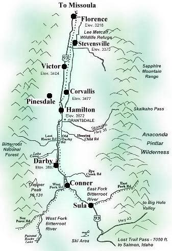 The Bitterroot Valley
- 25 miles wide
- 96 miles long
- 2394 square miles land area
- 6 square miles of inland water
Local Activities
Fishing
Crystal-clear mountain streams, tranquil lakes, and hidden “cricks” make the Bitterroot Valley a true haven for world-class trout fishing. The Bitterroot River—renowned for its gentle currents and easy wading—is every angler’s dream. Cast a line for native Brook, Brown, Bull, Cutthroat, and Rainbow Trout, as well as the unique Cutthroat/Rainbow hybrid and Mountain Whitefish. Convenient state fishing access sites line the river every five to ten miles, providing perfect entry points for wading or launching your next half- or full-day float adventure.
The high alpine lakes of the Bitterroot Mountains also offer superb fishing, some requiring a bit of a hike to get to, but well worth it. The largest of these lakes and the most popular recreation area for water sports is Lake Como, easily accessible, which contains both cutthroat and rainbow trout.
Other smaller streams, such as Skalkaho Creek and Bear Creek, offer Native cutthroat, some Brown trout, and Mountain Whitefish. Most streams in the valley pass through some private land; Montana law allows the public to make recreational use of rivers and streams between the ordinary high water marks. Anglers can wade through a stream, walk along the bank below the high water mark, or float fish on any waters large enough to carry a boat.
Fishing is a year-round sport in Montana, with Summer being the high season. Most waters are in prime condition, free of spring runoff from late June through October. Some anglers like to get a head start in March or April before runoff. Alpine Lake fishing is confined to the summer months, here in the Bitterroot Valley. Water freezes the lower lakes in December and doesn't let go until March or April, making ice fishing a popular sport.
Montana's great fishing is the result of climate, geography, and geology. Aggressive conservation efforts are practiced to protect the habitat of wild trout and other species that thrive in these waters.
Hunting
In Montana, it's been said there are only three seasons: summer, winter, and hunting. There are a few places in the world where our hunting heritage is well respected and well represented as in Montana. The High country thrill of stalking elk in the Rockies on a crisp fall morning with a fresh sprinkling of powder snow is an awesome experience. The Bitterroot Valley offers the big game hunter an abundance of wild game, including deer, elk, moose, bighorn sheep, and a variety of smaller animals.
Bird Watching / Wildlife Refuge
Just north of Stevensville along the Bitterroot River lies the Lee Refuge, which was named for former Stevensville Metcalf, who was instrumental in acquiring the land. The area is a delightful place for observing and photographing wildlife, such as deer, coyotes, pheasants, grouse, osprey, songbirds, Canada geese, trumpeter swans, blue heron, and a variety of other waterfowl and small animals. The 2800-acre wildlife refuge has a picnic area, two interpretive trails, and several foot trails providing access to the river.
Fishing is allowed in this area, but not on the refuge ponds. Public hunting for deer and waterfowl is permitted in portions of the refuge, subject to federal and state regulations.
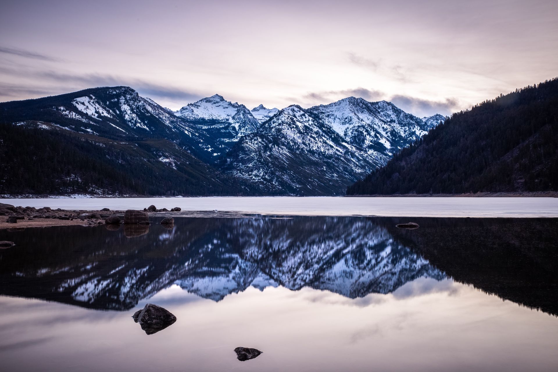
Winter in the Bitterroot Valley
Winter brings a different kind of beauty to the Bitterroot
Valley. Snow-covered landscapes, wildlife moving to lower elevations, and quiet
backcountry terrain create memorable outdoor experiences. Lost Trail Powder
Mountain, located at Lost Trail Pass, is known for deep snow, sunny days, and a
relaxed mountain atmosphere.
Snow creates a perfect stage in Montana's back-country, making it easy and fun to identify animal tracks imprinted in the snow. Perfect powder snow and brilliant blue sky are some reasons why people say Montana is at its best under a blanket of snow. These are, of course, skiers, snowboarders and snowmobiles.
Lost Trail Powder Mountain Ski Area: At Lost Trail Pass, elevation 7,000 ft., you'll find Lost Trail Powder Mountain Ski Area and Lodge Base. The ski area, now over 60 years old, has the best snow depth (over 300 inches) and the highest quality snow found in the northwest. On the average, Lost Trail has 85-90% sunny days, with temperatures averaging 20 degrees. Lifts transport fun seekers up 1200 feet from 6,800 feet to the top of the mountain at 8,000 feet. Choose from a total of 38 trails, with 18+ well-groomed runs extending from Montana into Idaho.
Skiing on "natural" snow at elevations above 6400' gives the skier groomed runs along with western powder, like no other area has available.
For cross-country skiers, the Bitterroot Cross Country Ski Club maintains the Chief Joseph Ski Course. Trails are groomed Thursdays, and there is a parking area along U.S. 43.
The Lost Trail Winter Park Area also offers great mileage for the snowmobile through Forest Service road systems, open parks, meadows, and rolling hills with little danger of avalanche. Snows come early and stay late in April, so if you're looking for a real outback adventure, this is the remote area for you.
Other downhill ski areas within 1-1/2 hours of Hamilton: Montana Snow Bowl North of Missoula, 30 runs, 20% beginner, 40% intermediate, 40% advanced, 700 acres of extreme skiing.
Local Information Links
Government Offices:
Schools:
Travel Information:
Other Resources in Area Information


